Students and Professors Use Drones to Research Air Inversions and Wood Smoke
Under the direction of Dr. Nora Traviss and Dr. Chris Brehme, and with assistance from KSC grad JC Woodward, KSC students are conducting environmental health research on the effects of air inversions on wood smoke concentrations in the Keene valley.
Dr. Traviss, an Environmental Studies professor, has been studying the effects of wood smoke and air pollution in Keene since 2010. Dr. Brehme, of the geography department, joined the study in 2015. The study is funded by a grant through the EPA Healthy Communities program.
The Science
The concern lies in the unique local topography where the city sits. Keene is a flood plain bordered by hills on three sides. Air inversions occur when a warm layer of air becomes trapped between two cold layers. When these inversions happen in Keene, the particulate matter created by burning wood stoves is trapped in the valley and cannot disperse, resulting in poor air quality.

“We’re working on the science behind predicting air inversions, so we can ask residents to not burn wood when inversions occur,” said Dr. Traviss. “The models that the state and the EPA develop look at air about 5,000 feet up and we’re finding that air inversions in the Keene area are occurring slightly above 300 feet. Therefore, to predict what’s going to happen here in the Keene area we have to use our own, local data,” said Traviss.
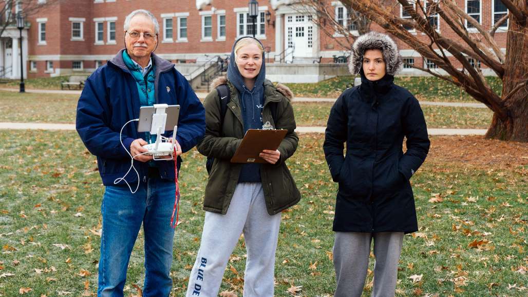
Environmental studies students Gwendolyn Thayer ’19 and Kaitlyn West ’19 are working with JC Woodward to fly an unmanned aerial vehicle to gather altitude and temperature data that determines exactly where the air inversion is occurring. Supplementing this data gathering is the installation of air quality sensors around the city of Keene with the help of citizen scientists. These sensors are connected to a main computer at Keene State that stores wood smoke concentrations in nearly real-time.
A digital map then visually displays air quality in the city based on this data. This up-to-the-minute data can be used to determine air quality at any time and can also be used as a historical record to help develop a Keene valley-specific model for predicting air inversions.
Public Outreach
The main goals of the study are to educate the community about local air quality dynamics and to provide timely alerts when conditions are unfavorable for burning wood. Forecasting air inversions and making the concentration map available to the public via social media is part of that effort. Environmental studies major Elizabeth Abrevaya ’21 will be working to engage the public with these goals in mind.
Under the direction of Dr. Tom Webler, Elizabeth is working on the public outreach piece of the project, managing the Facebook page Keene Clean Air. The page is used to educate the public on the dangers of wood smoke particles, the science behind air inversions and best practices for burning efficiently. It will also serve as a way to communicate to residents when they should refrain from burning wood, using the data collected through the research.
Hopefully, as more local residents have access to up-to-date air quality data while gaining an understanding of how wood smoke particles and air dynamics work, more will be motivated to participate in the collective effort to keep Keene’s air clean.


